Click the images for a higher resolution.
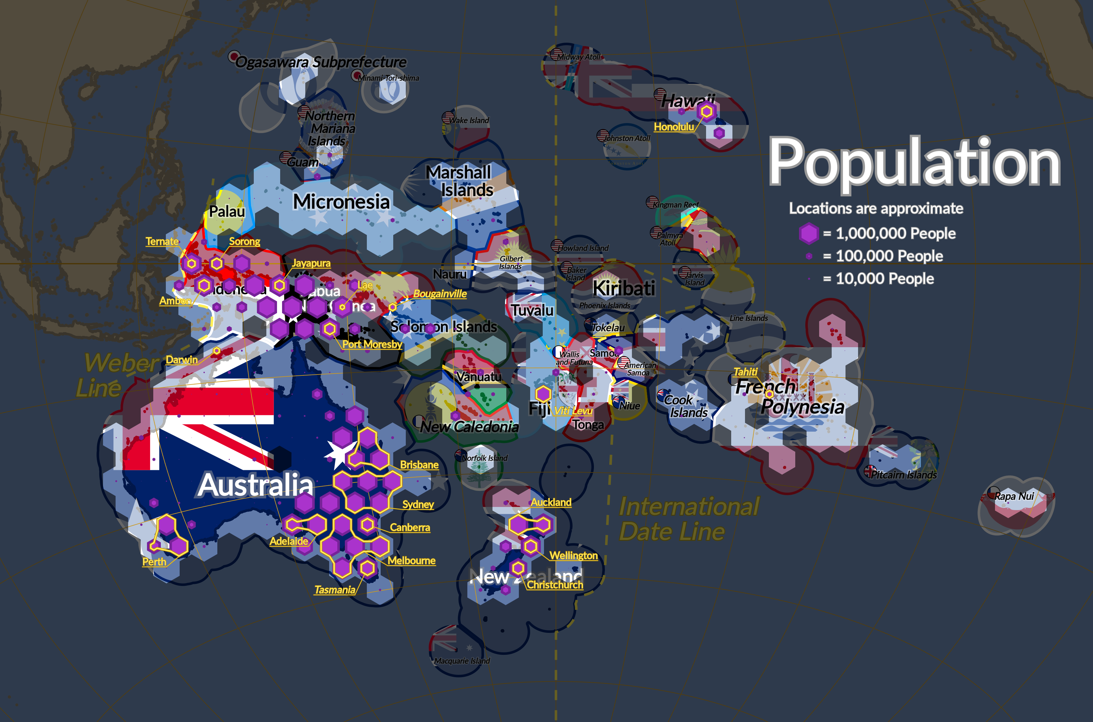
Darkened areas are either outside Oceania or have no people.
I was inspired to make these maps by the version of the same concept done by Lamp in this video:
https://www.youtube.com/watch?v=VR34TUhJEEs
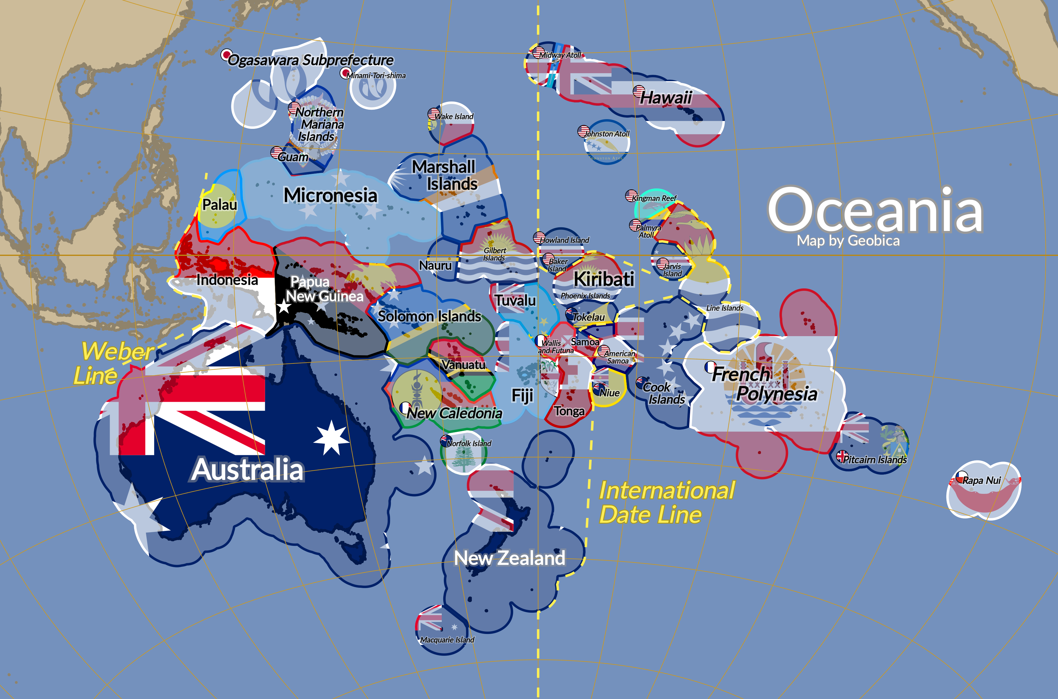
I felt that a flag map of Oceania like this could be very useful as it makes it easier to get a sense of where all the islands are in relation to each other, when on a typical map they're too small to see most of the time. The flags also do more to help find countries as typically on a map of countries you'd have the shapes of countries to recognize, but that doesn't work as well in Oceania.
On the population map, I tried to highlight any city with a population of at least 100,000, but for some, especially in New Zealand, there just wasn't anywhere I could fit it due to the hexagonal tile style I used. The reason I used those hexagons though is because other common methods of showing population, like cartograms and choropleth maps, just don't work when you can't see a lot of the islands.
I also have some alternative versions that use some more far-fetched unofficial flags for the US minor outlying island territories, as I think they're fun: